Our path goes up and down the slope of the mountain, but none of the climbs are particularly significant or difficult.
When you reach the hamlet of Sirta (elevation 249m), the first in the municipality of Cosio Valtellino, the path re-enters a wood and then drops down to the next hamlet: Piagno (elevation 219m).
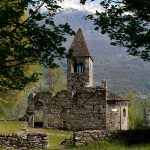
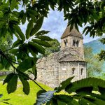
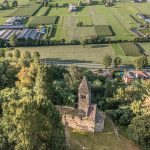
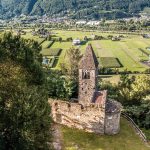
Between the houses in Piagno, pass by the stream of the same name and follow Via Biella straight to the Vallate abbey. The morphology of the slope here reveals a slippage; indeed, there is a crest between the bottom of the valley and the main slope itself. The cobbled road follows the watershed and, between beautiful meadows, reaches the plain containing the remains of the monastic building, enchanting both for its location and construction.
The route continues uphill along the road which is now become a dirt track. After a few curves and a couple of harpin bends, you will reach a clearing from which you continue left, following a path marked with the number 6 and the destination ‘Dossa’, along with other routes which show how this slope was heavily populated in the past, despite being in the shade.
The pathway then carries on, leaving the dirt track behind. The red and white signs of the CAI point the way. Carry on walking uphill, alternating between a very gentle slope and quite a steep incline. You will come across a number of junctions, which are all signposted. In any case, keep heading in the direction of ‘Dossa’.
You will firstly reach some well-restored lodges, two of which are now used as farm holidays.
After your gastronomic pit-stop, the pathway continues along the small tarmac road to Dossa. The Dossa Lake (elevation 521m) is in a small marshy area surrounded by aquatic plants. Pass by it towards the small chapel which welcomes worshippers from the surrounding lodges and continue along the slope. On one of the walls alongside the road you can admire some sculptures carved into the rock. These are sacred and mythological figures made by the artist Angelo Gabriele Ferro and can be considered as a miniature imitation of the famous faces carved into Rushmore Mountain in the Rocky Mountains.
When you reach a harpin bend, you will see the provincial road which connects the valley bottom with the Val Gerola (S.P. 7). Continue for about another 600 meters uphill, passing another farm holiday.
When you find yourself just below the lodges of Canleggia, at the elevation of 502 meters, leave the road and turn right onto a path which almost immediately leads to the local road of Canaleggia.
At elevation 581m, cross the tarmac road and continue on the path, still uphill, bordered by walls demarcating the route.
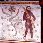
It is pretty hard work until you reach Roncale (elevation 664m), where you will find some more lodges and a small chapel with a fresco depicting the crucifixion dating back to the beginning of the 19th century. When the surface changes to tarmac, turn left and walk for a few dozen meters: then turn right towards the mountain, immediately intersecting a pathway which comes out into the woods, without needing to walk uphill any longer. Continue along the slope, and you will find another lodge and a fountain in a clearing.
Shortly after, the pathway feeds into a dirt track which leads steeply upwards: turn right, climbing to a slightly higher elevation to la Quiete lodges (elevation 761m). Here, the road starts to widen, winding through clearings. Turn to the right at the next junction and follow the path as it leads to a plain on which is perched the small church of San Bernardo which faces the Bitto Valley.
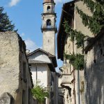
This religious building marks the entrance to Sacco (elevation 678m). Take the road downhill turning left onto Via Pirondini until you reach a museum called ‘Casa Museo dell’Homo Salvadego’. Then leave Sacco by passing the parish church (note the beautiful frescoes on a house in the same piazza) and take the mule-track leading to Morbegno (Via Cimitero).
The cobbled mule-track which leads down to Morbegno is the centuries-old entrance road to Val Gerola and the passes which cross the Orobic mountains, leading to Val Varrone and Valsassina.
After the first section which drops gently downhill between fields, cross over provincial road 7 and continue down along a road with three harpin bends before reaching the plain of Bona Lombarda.
This is also the name of the small chapel standing in memory of the actions of Bona Lombarda, originally from Sacco and consort of the Visconti captain Pietro Brunoro, who fell in battle in 1468 against the Turks. After passing the lodges at Campione and the paths to the left which lead down to Cosio, the mule-track continues downhill through a chestnut grove.
After quite a while, you will approach a group of derelict buildings with a small Baroque church, unfortunately now in ruins. Continuing downhill, a view of nearby Morbegno opens up in front of you, over the roofs of the historic centre and the wide valley floor. Leave the cobbled path at an harpin bend and walk down a series of steps on the right to take a more direct route.
Passing below the first and highest houses of the town, we eventually arrive onto Via Cotta, at the same height as the bridge over the river Bitto, decorated by the statue of San Giovanni Nepomunceno, protector of anyone who should fall in the water, hence why his statue is often placed on bridges. At this point, take Via Pretorio to enter the historic centre of Morbegno.
Continuing along the straight Via Nani we reach the Morbegno Fs Station, the final point of the Trail.
