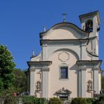
The route climbs up between the church of San Rocco and the graveyard of Bellano, then it steps towards Ombriaco passing under two road bridges.
Without entering into the old part of the village, the route turns left at a wash house and intersects the tarmac road several times as it climbs the slope before reaching a wide wooded meadow behind the sanctuary of Lezzeno (elevation 366m). It’s the perfect spot for a long break.
Then you continue along a short section which weaves between the old houses and the mountainside; you pass alongside the “Cappella del Miracolo” before arriving at a junction close to a watershed.
Here you have to bear left and walk steeply downhill; turn and cross the street to continue along the pathway directly below. In front of you, on a raised section of path, you will catch a glimpse of a beautiful landscape with a few vines, cultivated terraces and some hillside lodges. From here, the path falls into a narrow valley before reaching a clearing with some old ruins. You will notice some hollows carved into the side of the walls. There are overflows of water which run off from the meadow above: in the past, they were used as reservoirs in the event of drought.
The route then crosses several small valleys, including the Valley of Mils, recalling the bygone presence of these constructions. At the summit of a short incline, the pathway turns right towards Pendaglio, then drops sharply left towards Oro (elevation 297m).
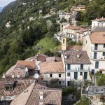
In the past, Oro (together with the nearby hamlet of Verginate) was renowned for the production of good sweet wine. The church of San Gottardo, saint of travellers, was built between 1569 and 1579. Here, there are two options: to follow the tarmac road to the right, or go down a few steps and pass by the houses of the old village before re-joining the road further along.
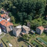
Having passed the pretty hamlet of Oro (elevation 297m), the path continues for a while along the road and arrives among the low meadows of Verginate (elevation 330m), Bellano’s last hamlet. It’s a good idea to go slowly here, and take a look behind you to admire the view of the lake, or appreciate the details of the landscape. You can see traces of an ancient settlement, built on a difficult slope, and carved into terraces which still bear the signs of vineyards and olive groves.
After passing the shady Grande Valley, you will enter the town of Dervio. Here, the path reveals all of its immense beauty: the cobbled base, edged with a small wall running up to a small Baroque chapel. This section of the route is undoubtedly outstanding.
We are among the cliffs of Ronchi (elevation 362m), meaning the arrangement of slopes into terraces supported by terreplein above the lake. On the edges of the path, there are gardens and vegetable country houses on either side. A carving on a rock shows the date 1693. Various tracks lead upwards and lead into the mountains, for the seasonal rearing of cattle, around the summit of the Muggio Mount.
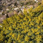
Further along (Via ai Ronchi) the pathway hewn into the rock continues. It is occasionally characterised by the centuries-old marks left by sleds. Some steps carved into the rock can also be seen. Thanks to better sun exposure, this is home to scotch broom and other sun-loving plants. The gaze is directed towards Dervio; the mountains of the western valleys rise beyond the stretch of the lake. Walkers will also notice the carving of a geometric shape on a large mass smoothed by an ancient glacier, which could have been a rudimentary maze or a game.
The path drops down to a flat section; it passes by the houses of Chignolo, and comes to the old national road at a railway bridge and the Crotto del Cech (elevation 218m), a nice resting spot, now at the edge of Dervio, which can be reached by going straight along Via Duca d’Aosta. Along this road, you should take a look at one of the last stone ruins on the right side, with an unusual and elegant double curved window and dovecotes above.
