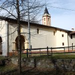
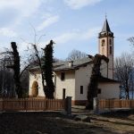
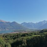
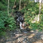
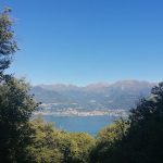
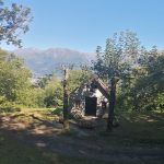
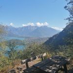
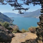
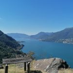
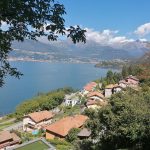
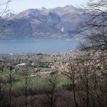
Before you get there, you will pass over a ford from a stream (with the remains of mils) and walk behind the church of Dorio, dating from at least 1412. It is worth stopping a moment at the porch of the small church of San Giorgio, the old parish church of Dorio, to appreciate the beautiful view over the lake and the houses of the municipal capital Dorio below.
After passing behind the church, you will reach Mandonico (elevation 302m), with its rustic houses following the undulation of the terrain, some arranged along the route and others among the grassy slopes. Many of the houses appear modest in their construction, but one, on the way out of the village, has the look of a palace. However, it retains its rustic aspect with exposed stonework. After the diversion on the left which drops down to Dorio and the train station, the route continues through the folds in the mountainside. Start to climb up through the chestnut grove towards the chapel of San Rocco and the boundary which separates it from the Colico shoreline.
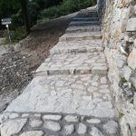
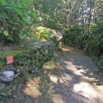
This section is particularly beautiful: especially the mule-track, which appears to be built around 100 years ago. It is also interesting to point out the structure of the rock: we are no longer in the land of limestone which has surrounded us since Bellano and here a schist rock predominates (tiny mica schists and gneiss), occasionally crossed by amphibolite veins, such as those close to San Rocco. Vegetation growing over the emerging rocks loses its woodland cob room and brooms and other plants which love the intense sun exposure on this slope spread.
The chapel of San Rocco (elevation 487m) signals your arrival at the Ronchi di Vesgallo (elevation 555m), in the end of this section of the walk.
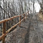
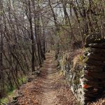
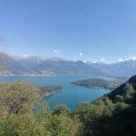
After San Rocco, two stepped climbs bring you to the edge of the spur which faces onto the small lake of Piona (scenic viewpoint). The bare rock, sculpted by quaternary glaciers, leaves wide gaps in the vegetation, where chestnut trees stand next to bendy birches and the beech trees. The mule -track runs steeply down the side of the mountain, passing by a number of small chapels. Now and then, if you keep a close eye on the verges, you will see several boundary stones showing the various sections into which the land used to be portioned for firewood.
La mulattiera corre precipite sul fianco della montagna incontrando qualche gesuolo. Ogni tanto, scrutando i bordi, si notano dei ceppi numerati che indicano i lotti in cui un tempo era ripartito il bosco de legna.
Further on, the route winds along the shady Rossecco Valley; here, the mule-track quickly rises up some large stone steps; the path then stretches out and becomes less steep, by a bright clearing overlooked by ancient chestnut trees. This is ‘Monte Perdonasco”, one of the many seasonal settlements which occupy the northern slope of Monte Legnone. In the past, people would come here for chestnuts and firewood.
Passing over the Valle di Voh, you will immediately reach Monte Sparese and the isolated church of Madonna Regina dei Monti. These ‘mountains’ belong to the municipality of Dorio rather than Colico, whose plain is now very close by. This is due to a ruling of 1755 which ended a violent dispute between the two communities. This also explains the beautiful and solid structure of the mule-track to this point. The small church was built to enable mountain dwellers to worship during festivities without having to return to the far-off parish church of Dorio. After Monte Sparese, a cement road appears which you follow downhill for a long way (with shortcuts), on the shady slope of the wood, until Posallo (elevation 433m) where there is a welcoming place to rest and where should, if you want to, can head down to Colico train station.
Having passed Monte Sparese (elevation 611m) and taken the road which follows, the descent towards Posallo begins. Then you walk down through a chestnut grove where some clearings have been made in a number of places. In the undergrowth, you can observe isolated masses of rock which were transported here by quaternary glaciers; some of them have hollows carved out by the ancient inhabitants of the area as part of pagan worship. The road makes some harpin turn before converging at the foot of the slope where the peneplain of Colico fans out before you.
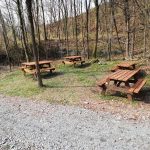
In Posallo (elevation 433m) there is a holiday farm and a trattoria. If you follow the tarmac road, you will arrive at the first few hamlets of Colico (Borgonuovo, Corte) and at the station of Piona, where the trains seldom stop. The Sentiero del Viadante turns right at a farm. Cross a bridge over the Perlino river and, following a mule-track, climb upwards for a few dozen meters until you reach the church of San Rocco (elevation 480m), next to a pretty clearing with stone tables, among meadows and chestnut trees.
This church has antique origins, as shown by its Roman apse, and was initially named after San Sebastiano according to an image of the saint inside the building which, however, never earned the name of parish church, but was simply a place of worship. The frescoes inside, dating back to the 14th-16th centuries, depict the Last Supper along 6 meters of the wall with a crowd of commoners looking on and the martyrdom of Saint Sebastian. The latter work dates from the 16th century and is of particular artistic value. In 1401 a bell tower and porch were added during a reorganisation of the building. Having passed the church and crossed through a chestnut grove, you will be upon a tarmac road. Historical sources state that the original road towards Valtellina ran along lower than this one, between the hamlets of Colico, avoiding the undulations which the pathway now involves.
