LOW ROUTE
From the crossroads located just below Genico (elevation 280m), you follow the path to the left, among the ‘village’ fields, remnants of a ‘lake landscape’ oppressed by the expansion of settlements and, in the past, an indispensable agricultural supplement to the economies of fishing and forestry.
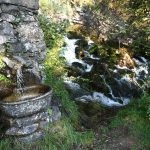
At the turn on Via Ciserino (beside a stone fountain) the path turns left downhill to the homonymous nucleus (elevation 243m). Here it right onto Via Regoledo coming out among the meadows. After a short stretch along a service road to the motorway you notice, on the right, the path to Coria. The long and beautiful ascent to the Coria Aps thus begins.
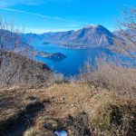
The stairway that climbs from Castello di Lierna comes from the left at the first junction. You pass the Cascina Nero (elevation 378m) with a votive shrine and then, after reaching a panoramic viewpoint, go around the slopes of Sasso della Botte until you gain, among the chestnut trees, the terrace of Coria (elevation 780m), the highest point of the Low Variant trail.
In Coria there is a fountain and a farmhouse among wild meadows. At the junction of the trails, a link road branches off upstream, which via Bocchetta di Ortanella (elevation 961m) connects with the High routes. Along this track, you will cross Prato dei Spini, a scenic area equipped with a bivouac, also accessible to visually impaired people. Instead, the Low variant proceeds to the left, beginning the descent toward Varenna.
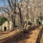
After Coria (elevation 780m), the trail reaches the rough Vacchera valley. In the past, among these cliffs, the inhabitants of Esino rolled logs down to the lake along gullies called ‘oghe’. The trail, descending moderately, reaches Roslina (elevation 699m), where the ruins of two huts remain under the foliage of an enormous horse-chestnut tree. Coria and Roslina were once inhabited once, perhaps occasionally, but someone used to keep the human presence alive and exploited the natural resources of the place like wood, chestnuts and hay.
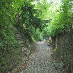
At that point you walk down into the woods to pass Val Pietfer, beyond which there is a striking section of steps carved into the rock. The path is replaced by a wide paved mule track that, after having reached a cross, finally arrives at a service road of the S.S.36.
A few meters before, however, the usual orange sign (elevation 330m) indicates the new direction of the route, which climbs back up along a slope of debris and passes the freeway tunnel. Continuing straight ahead it’s possible to descend to Pino and Fiumelatte and proceeds alongside the road.
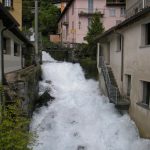
For a while the path runs alongside the motorway, then it enters in the bowels of the mountain and returns to the forest in a cool, damp environment where seedlings of hirsute epilobium and valerian stand out more than elsewhere. At one point you leave on the right a path pointing with another tour toward Vezio, and continues along the coast, bypassing from above the little valley from which the Fiumelatte flows.
You pass under the Bulwark (elevation 310m), a grassy open space surrounded by tall cypresses.
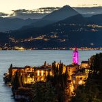
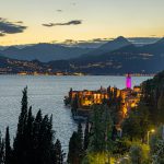
Shortly you reach the enclosure of the Varenna graveyard (elevation 280m) and exit onto the entrance square. After few steps downhill and on the right, you take a ramp uphill that at the top, after a few iron steps, turns into a path among steep clover meadows. The ascent becomes a bit hard but is short: in fact, having reached a curious, decayed garden, it turns flat on the part where the village of Vezio stretches out, while the crags of the castle hill loom to the side.
In Vezio (elevation 350m) you meet the High Route of the trail.
