HIGH ROUTE
Through the picturesque centre of Genico (some houses date back to the 18th century, alongwith a fountain with a sundial and two oratories), the path, which is also signed as route 71, goes under the motorway and turns right up a ramp. It then skirts around a clearing and, still climbing, comes closer to the shady Brentalone Valley. The path gives you a good view of the valley’s shape, made up of huge limestone steps.
The route moves past the the Zucco della Pecora cliffs (elevation 735m) and, higher up, enters into the large valley before crossing it and climbing again up a steep series of winding paths, sometimes carved out of a rock itself, and sometimes cobbled.
When you start to get short of breath, you will reach the Brentalone Cross, one of the typical bases often seen on mountain paths, which marks a change in the gradient. The next part of the route is easier indeed. It continues through the chestnut grove among carpets of cyclamens, until it reaches Alpe Mezzedo (elevation 871m), where you can still catch a glimpse of the glacier.
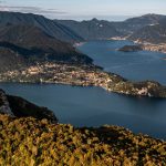
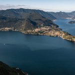
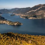
Continuing on, just above the mountain, you leave path 71 which continues onward to the Lierna Apl and bear left. The edge of the S. Pietro plain is now close but before it, you get to a wonderful panoramic view (see the following page). On the edge of the plain, with a few benches and tables, there is the church of San Pietro (elevation 992m).
Pietro is the highest point of the entire route, at an elevation of 992 meters (795 above the level of the lake). At the church you can see the dirt track leading from Esino Lario. Our route follows it, skirting along the karst plain of San Pietro before turning into a path to the left (signposted) which drops down into a wood and leads to Ortanella, a small group of houses surrounded by meadows. Here you meet a road leading up to Coria (Low route).
You can see huge beech trees dotted around the clearing. In the past they were saved from being chopped because they mark the edges of a municipal boundary of property. The beech tree is the most common tree at this particular elevation. Around the small pond of Pozza, which is rare in a limestone area and struggles to hold on to surface water, you can see alders, lindens and aquatic plants which offers protection to insects and amphibians. If you are looking for a place to stay the night or to eat, you can see the details of locations in Ortadella which are provided below.
From Ortanella, the path continues northwards, along a dirt track and, after passing the houses at Guillo (elevation 952m), weaves through the beech trees and up the slopes of Fopp Mount, offering an interesting view over the wide Esino valley, the deep basin which drops down to the lake and the mountainous crest which acts as a diving line with Valsassina.
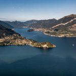
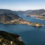
Leaving the meadows of Ortanella behind you, the pathway turns to the lakeside slope, descending the ridge between the valley of the Esino stream and the lake shoreline. It finally arrives to the hill Vezio and then Varenna. The next section is extremely beautiful, weaving its way through the trees. At times, the path faces the lake, overlooking high cliffs. Walkers can enjoy splendid views of the lake’s central basin. ‘Fopp’ is a dialect term meaning ‘depression’ or ‘basin’: in fact, the zone is full of limestone cavities.
Leaving the road which winds around Monte Fopp, you follow the valley along a wooded track (signposted, elevation 981m). It retraces on old route; hence why parallel tracks can occasionally be seen in the undergrowth. When it reaches an isolated farmhouse (Alpe dei Fopp, elevation 780m), the track becomes smaller. It drops down steeply at the side of the Sass da Poo (elevation 753m) and then just out along the crest, alternating between shady sections and grassy cliffs. Small remnants of walls protrude from the brush: they are the foundations of constructions which were part of the mighty Sass da Poo Tower, used for communications during the Byzantine period when the Lario was threatened from all sides by hostile forces invasions. As soon as you are at the foot of the Sass you will see an old mule-track from Esino on your right.
The crest moves increasingly in the direction of Varenna and reaches the Croce del Fopp (elevation 577m) from where Vezio and its castle can be seen. The path, a little sunken down, continues downhill, passing by the ruins of a chapel (elevation 510m), some pretty farm buildings and reaches the first houses of Vezio where the low route, which will be described below, re-joins the path.
